


The Government of Dominica, through the Ministry of Health and Environment under the Disaster Vulnerability Reduction Project, is set to commence the Topographic Surveys of the LiDAR Bathymetry and Topography Survey, Data Analysis, Modeling and Development of High Accuracy Terrain and Bathymetric Models Sub-Project.
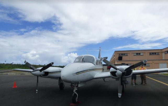
The contract for the LiDAR Project was awarded to McElhanney Consulting Services Limited of Canada on May 3, 2017.
The company completed the LiDAR Bathymetry Surveys in June 2017 and has now mobilized to undertake the LiDAR Topographic Surveys of the island from February 21, 2018 to coincide with Dominica’s dry season.
The purpose of this project is to assist the Government with improving disaster and climate resilience through various activities including rehabilitation of infrastructure, development of tools and modeling systems to support engineering scale analysis, and coastal and hydrological processes throughout the island.
This will be done through (1) data collection, (2) data analysis and modelling, and (3) training and technology transfer.
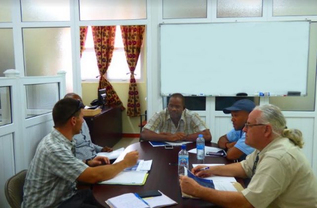
This project is supported by the LiDAR Technical Working Group comprising the Lands and Surveys Division, Fisheries Division, Physical Planning Division, Office of Disaster Management, Dominica Water and Sewage Company (DOWASCO), Dominica Meteorological Services, Division of Agriculture, Forestry, Wildlife and Parks Division, Information and Communication Technology Unit, and the Ministry of Public Works and Ports.
Dr. Tim Webster is providing expert assistance for the project for the Quality Assurance/Quality Control of Aerial Orthophotography, LiDAR Terrain and Bathymetry Data Acquisition, Analysis and Modeling, and associated Support.
The data and products to be derived from this LiDAR project include Digital Terrain and Elevation Models (DTM and DEM) and Bathymetric (BAT) Models which will be used for the development of hydrological models to analyze water flow, drainage management, flood control, land stability, and areas vulnerable to landslides. The survey will also provide information on forest conditions, and support and further strengthen land use planning activities.
Orthophotos of the island will also be collected which will provide spatial information including features such as roads, rivers and vegetation.
Global warming and sea level rise are increasing climate risks as seen with the impacts of Hurricane Maria in Dominica. Therefore, establishing high quality data is critical for mitigation and resilience planning in the event of future disasters.
The LIDAR project is expected to be implemented over a period of twenty-one (21) months to a tune of approximately EC$ 2, 223,000.
Where can we obtain the lidar data?
Sounds like a really promising initiative for the Nature Isle… Let’s hope that such invaluable data will truly go into informing current & future land use practices, while enabling Dominica to become & sustain itself as an authentic Climate intelligent/ resilient, & land use prudent nation. Also, It will definitely offer a treasure trove for all respective sectors to benefit from the survey information on forest conditions etc, as a means to long term disaster mitigation & resource enhancement, as well as learning from the Orthophotos of the island, which will provide key spatial information including features such as roads, rivers and vegetation conditions. This will certainly better inform our ongoing infrastructure management, engineering & planning decisions post hurricane Maria.
If this instrument can be adjusted i would suggest also taking infrared images of Dominica. This would help identify hot spots to create geothermal maps. I know a bunch of areas in Dominica with hot springs formed by water contacting near surface magma. This could help ID heat source.
Government is doing a $2 million aerial survey, but can’t collect the garbage or fix the roads…WOW!
This shows you where to put the garbage and which roads to fix and stabilize from flooding.
All those are in the works, one at a time please. How about drainage, tree-lined streets, baby feeding, tree planting, int’l airport, underground tunels, buried cables……current situation is so huge it’s unimaginable.
I think that there is another agenda for what they are doing re information gathering other than the reason that they are stating. Who is paying for it? Anyone can already see how prepared this government is regardless of preparation and studies when it comes to disasters.
This is very good tool for planning and development. It is expensive but if data utilized properly will be very good asset for listed departments. On the ground field observations still important but definitely helps in the scientifically informed decision making.
Oh oh Shaka I find U come out. …that’s quite a departure from promoting handing over the island to the other fellas midstream
Thats the problem with us. All i care about is practical honest forwatd thinking governance. The current administration has been forming the royal A. When things screwed up we call it out and demand what is best. If a program makes sense we give credit. I have been calling for scientific informed based decision and this remote sensing technology provides an opportunity to do that. What does tbat have to do with handing to the other fellas. I care about what is best for the country and after 17 years its time for change. However if Somthing makes sense we call it as it is. That does not negate the rest of the BS. The cost is not from labour party. Its from the gov of dominica that represents everyone. The information collected will be useful beyond any of us time on earth. If my thoughts seem to not align with whom you dont support so be it. I stay informed and thats all. We have to hold every public servan acountable to thier duties acckrding to the laws of the land. That it.
This data should be published to the public once completed.