


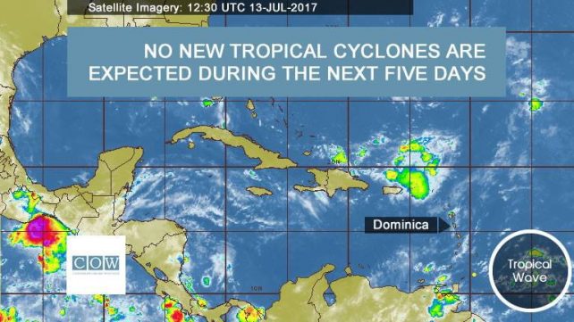
A westward moving tropical wave located in the Tropical Atlantic is expected to approach the Lesser Antilles by tonight into Friday.
This will result in an increase in cloudiness, shower and thunderstorm activity on Friday into early Saturday.
The presence of dry Saharan air and dust continue to hinder the development of these waves.
Slight to moderate seas are expected during the next 24 hours with waves peaking near 7.0 feet.
It should be noted that a greater degree of cloudiness, more frequent rainfall and higher rainfall amounts are normally experienced across the east coast and interior of Dominica.
Disclaimer: The comments posted do not necessarily reflect the views of DominicaNewsOnline.com and its parent company or any individual staff member. All comments are posted subject to approval by DominicaNewsOnline.com. We never censor based on political or ideological points of view, but we do try to maintain a sensible balance between free speech and responsible moderating.
We will delete comments that:
See our full comment/user policy/agreement.