


Hillsborough Estate was once the site of one of Dominica’s several water-powered sugar mills, the ruins of which still exist today near the left-hand bank of the Layou River. In its heyday, the estate produced sugar, cocoa, coconuts, copra, tobacco, limes, coffee and other agricultural commodities.
The estate is also known for the Hillsborough Stretch, a section of the West Coast Road, measuring over 200 metres long and which, until Hurricane Maria was lined on the northern side with stately Royal Palms (Roystonea oleracea) interspersed with large Glory Cedar (Gliricidia sepium) trees; these pink-flowered trees annually added to the spectacle when they are in bloom during the earlier part of the year.
Importantly, however, Hillsborough Estate is associated with the Hillsaborough Bridges – also called the Layou Bridge – which span approximately 150 ft across the Layou River. The original bridge and final stretch of the river featured on a Dominican postcard some decades ago, and subsequently the same scene was featured on two local postage stamps during the reigns of King George V and Queen Elizabeth II respectively.
The original Layou or Hillsborough Bridge was commissioned in 1902 and was a single-lane bridge used by vehicular traffic coming from both ends but waiting their turn.
The following is Administrator Hesketh Bell’s account of the bridge from his Report on Roads and Land Settlement of Dominica, 1903: “The pier and abutments of the bridge had to be carried down to a depth of over 13 feet below the bed of the river, while the iron work stands 22 feet above the ordinary level of the stream.
“The bridge consists of two spans, of 120 feet and 32 feet respectively, and could bear a railway train. Mr. Miller (the engineer) completed the work for £2,293 and the bridge was opened for traffic on 15th of January 1902. Not only does it guarantee the safe transit of produce along the Leeward Coast Road, but it now ensures access to the fertile Crown Lands lying up the Layou Valley. The provision of this bridge also saves the Colony an annual payment of £50 for the maintenance of a ferry across the river.”
The 1902 structure was replaced in 1985 by two single-lane bridges which will be referred to later in this writeup as the Hillsborough East Bridge and the Hillsborough West Bridge respectively. Those bridges are important arteries connecting near-by Layou Village, the West Coast communities, as well as the north and north-east sections of the island to the capital city.
Both East and West Bridges remained functional until the passage of Hurricane Maria in September 2017.
The Layou, Dominica’s largest and longest river flows down a distance of some 11.3 miles before it empties into the Caribbean Sea. It drains an area covering over 27 sq. miles which is approximately 9% of the island’s surface and more than five times the size of the Dutch Caribbean island of Saba.

Since the construction of the Hillsborough East and West Bridges, these structures have been subjected to much battering during very high flows of the Layou River triggered by tropical weather systems and geo-hydrological events. These include Hurricane Hugo in September 1989; the two floods associated with the Carholm landslides of 21st and 28th November 1997 respectively; Hurricane Dean on 17th August 2007; the collapse of the Matthieu Dam and draining of the then over 140ft deep Matthieu Lake – a.k.a. ‘Miracle Lake’ – on 28th July 2011; Tropical Storm Ophelia on 21st September 2011; Tropical Storm Erika on 27th August 2015 and Hurricane Maria on 17th September 2017.
The two bridges were able to defiantly withstand the battering from huge, fast-moving, floating trees and logs being washed down to the sea at Layou until Hurricane Maria severely damaged the eastern bridge.
When the Matthieu or ‘Miracle’ Lake drained off this had caused the washing away of the middle one-third of the decking of the York Valley Bridge. Subsequently it was uttered in the media that that bridge, which was casually referred to as the ‘Glo Cho Bridge’ due to the presence of a popular hot spring upstream, had been “compromised”. The same term was used to describe the severity of Hurricane Maria’s damage to the Hillsborough East Bridge and other infrastructure island-wide, even though the bridge’s southern pier (pillar) and its footing had sank several feet into the bed of the Layou River.
Following the passage of Hurricane Maria, the Hillsborough West Bridge accommodated vehicular traffic traveling in both northerly and southerly directions, but commuters sometimes had to endure the inconvenience of a short wait at either end of the bridge.
The damaged section of the East Bridge is currently being repaired at a cost of almost EC $9 million and this project is expected to be commissioned during the first quarter of 2022.
Persons from the west, north or north-east of the island who have not journeyed to Roseau via the West Coast Road since the Hillsborough East Bridge got damaged as well as some Dominicans residing overseas would probably not be aware of the extent of the damage that was done to the bridge by Layou River’s high flow associated with Hurricane Maria.
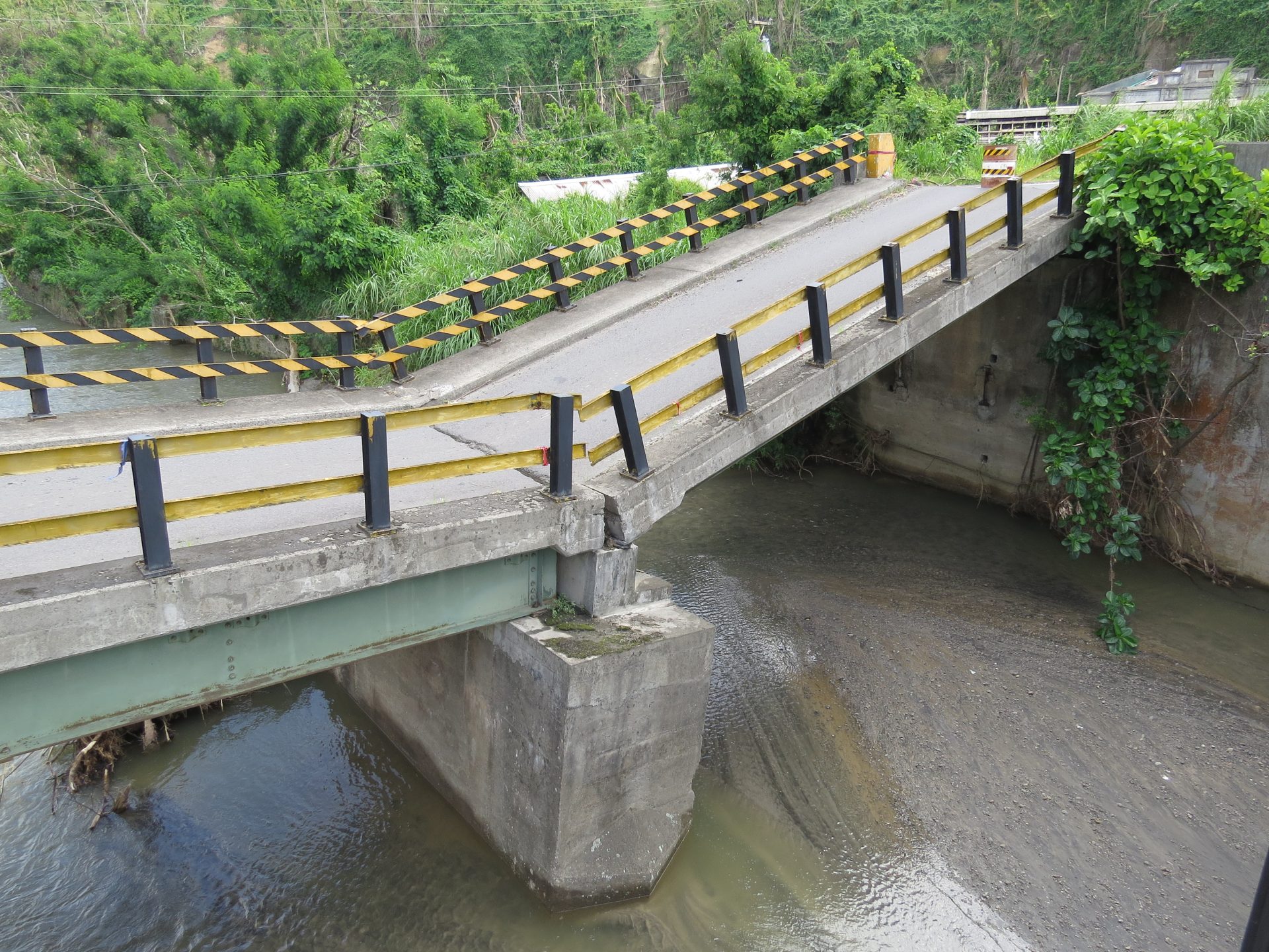
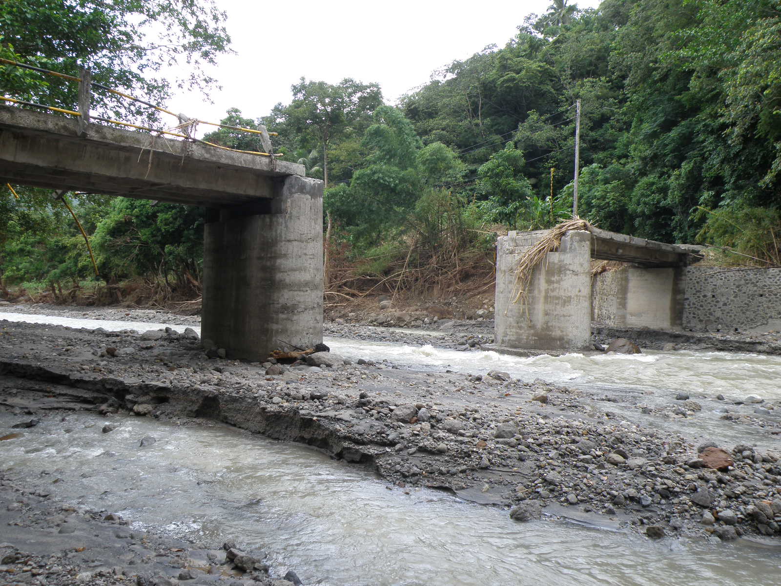
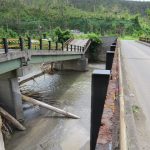
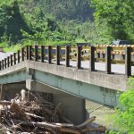
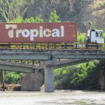
In order to satisfy my curiosity as to the extent to which the bridge had been “compromised” the writer journeyed to Hillsborough on 7th November 2017 to “let my eyes boil my peas” as we say colloquially, and to take some photographs of the damage. And the scene that greeted me was certainly more than just a bridge that had merely been “compromised”. (See next four photos)
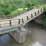
However, soon commuters traveling along the West Coast Road and having to cross over the Layou River at Hillsborough will be able to do so more safely and more comfortably as they did during the 32 years before Hurricane Maria.
Special Thanks to Dr. Lenox Honychurch for his inputs.
James, very informative article, My Friend!
Why build a bridge in the same area. Whenever a semi truck comes across the bridge traffic has to be at a standstill because of how wide the truck has to open in order to get out of the bridge. A bridge closer to the mouth of the layou river near the tarish pit and ending by the area the Sand barges are loaded would much better for national development. The countrys engineers and leaders should think forward and stop following the donkey tracks of yester colonial years.
Many of Dominica’s bridges are made vulnerable due to the engineer’s penchant for mid-stream piers; a design flaw made worse by the absence of cut waters. Recent Roseau bridges being prime examples.
These days the spans we are faced with can be easily done in one leap.
Twenty-five years ago I surveyed one of the earliest segmental cast iron bridges in the North of England. It dates from 1816 and spans a river the same width and as vulnerable to severe flooding as the Roseau River. Components for original span were cast by a local foundry and were designed to take the weight of heavy steam traction engines.
The bridge survives intact to this day.
To what extent does the decades of continued river mining and over weighted trucks affect the bridge’s foundation?
Anytime you see a country’s infrastructure in such a deplorable state, corruption is the reason. Greedy, corrupt politicians take the country’s money and pocket it.
What is truly sad is the inertia surrounding this blatant corruption.
Ibo, you are right. Like the one ALGEEZERA caught. The one whose signature Algeezera told us about. Making deals even when out of office and in opposition.
You are exactly right. The documentary featured Robbin’ Hood and his glamorous wife prominently. They were the two stars of the show. Wife and children lived in a multi-million dollar upscale residence in New York. Where did she get that money to support that high maintenance lifestyle? At the same time, Robbin’ Hood is/was in bed with numerous international crooks, gangsters and fugitives.
In any other jurisdiction, Robbin’ Hood would have been behind bars with silver bracelets around both wrists. Dominica is unique. People of shady character occupy the highest offices of the land.
i can’t help myself but to wonder about our technology in this modern era. why is it that we can not conceptualize and construct bridges which span such lengthens of 150 feet? this would allow for the unobstructed follow of debris in the river making the bridges a lot more resilient, especially seeing that this is our widest river. it is about time that the design criteria for those bridges gets updated to the modern times!
With Dominica’s history of dangerously flooded rivers and streams, all bridges should be built with no abutments. All bridges should be single-span. All our waterways are narrow enough to allow us to build only single-span bridges. But not only that; the bridges should also be raised (maybe except the Layou bridge) so that when there is a flood the water does not reach the crossing surface. In order to raise the height of the bridges, both approaches to the bridge must be raised at an adequate gradient. We must think outside of the old historical box. Civil engineers take note!!
I wonder if those bridges get periodic inspections to ascertain their safety and viability?
have a look at the pagua bay bridge going towards kalinago teritory . the steal I-beams under that bridge are so rusted that light is actually passing threw the web of the i beams