Community vulnerability maps and adaptation plans have been developed for ten vulnerable communities across the island. The maps were officially presented to representatives of ten village councils at a ceremony at the Fort Young Hotel on Monday, 18th July, 2011.
These maps will assist the communities in identifying environmental vulnerabilities particularly in areas relating to climate change and other pressing environmental risks such as landslides and earthquakes.
The project was spearheaded by the Environmental Coordinating Unit through a consultative process involving trained extension officers in various key government departments.
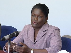
Chief Physical Planner, Annie Edwards, at Monday’s presentation ceremony, spoke to some of the environmental issues identified in various communities.
“In the case of Penville, the major issue we were concerned about is the earthquake vulnerability and the fact that there is this large seismic crack which appeared after the recent earthquake. So it gives you guidance on how to address or to mitigate some of these issues. Then Layou and Colihaut the main issues were the coastal pollution. There are a number of reasons for this pollution but you have, in both cases, quarries located very close and you also have issues of solid and liquid waste disposal. The plan will give guidance on how to address some of those problems. Soufriere, we also had issues of coastal pollution from solid waste disposal. This is especially critical because the marine reserve is located right there and Scott’s Head also some costal pollution. You also have a lot of landslides; areas in the vicinity of Soufriere that is vulnerable to landslides. For Marigot, we mainly focus on the impact of the airport construction; the sedimentation on the sea grass bed which is located just off the coast and also the threat of landslides because of the construction process,” she said.
Hon. Environment Minister, Kenneth Darroux, has welcomed the community vulnerability maps, saying that it is in keeping with Government’s continued efforts in building the island’s national adaptive capacity.
“The Government of Dominica is proud to announce to the world that we have now equipped our extension officers from the Forestry, Agriculture, Fisheries, Environmental Planning and Local Government Department with skills whereby they can produce community vulnerability maps and atlases as well as climate change adaptation planning. Through this programme, we would have fulfilled our objective of capacity building as these maps and plans provide you with the tools that will contribute to your discussion when development projects are considered. This is yet another example of how this Government is once again proving that it is taking the whole issue of climate change and its effect on our country very seriously,” he said.
The development of the community vulnerability maps and adaptation plans was undertaken under a collaborative initiative supported by two global environment facility funded projects, namely the GEF/ United Nations Development Programme (UNDP) Sustainable Land Management Project and the GEF World Bank Special Program on Adaptation to Climate Change Project.
The project was funded at a cost of $500,000.00.

This should read:
Environmental Coordinating Unit(ECU): THIS IS THE NEXT LEVEL!! I am pleased with your efforts along with your partners.
ECU is not about planting flowers, it is about bigger things which would take us to a higher level!!I am proud of ECU!!
These maps are extremely important in any development plans and and activities in the communities. They are a basic tool and this must be emphasized. Environmental Coordinating Unit:
This is a good thing that was done, but I am still worried about disaster reparedness re the volcanoes. Nobody seem to want to deal with this, but people need to know what to do when that alarm goes off.