


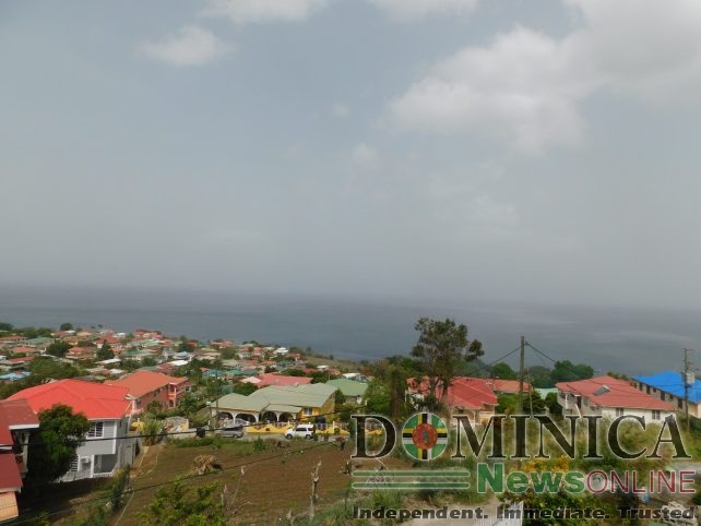
As the Saharan dust haze continues to blanket the island chain of the Lesser Antilles, weather officials continue to warn the public about its risk to health.
The dust is transported by strong winds set up over the Sahara Desert in Africa and over the Atlantic Ocean.
“We are having a thick plume of Saharan dust haze; this is expected to continue to blanket the island chain including Dominica,” Acting Senior Meteorological Officer, Marshall Alexander said during a live interview on state-owned DBS Radio on Tuesday morning. “If you notice , we are experiencing some strong winds and these activities are most noticeable during the hurricane season.”
He continued, “You see the evidence on vehicles, complaints of allergy reactions and we expect to see a decrease in intensity as the day progresses and into tomorrow, Wednesday.”
Alexander said that the effects will be relatively dry conditions, dusty conditions and a significant reduction in visibility.
In terms of precautionary measures or preparedness action, the Met Officer reiterated that people with respiratory illnesses should take necessary precautions to minimize complications.
“Precautions such as staying indoors, taking measures to keep dust out of your home, avoiding outdoor activity, wearing of masks as we continue to do for Covid-19, keeping your medication and rescue inhalers close at hand, using air purifiers for those who have them,” he advised.
Alexander also reminded small craft operators to stay in port especially if GPS is not in use on their vessel.
“A Small Craft Advisory is in effect for above normal seas,” he stated.
He said `although the Saharan dust haze is not an unusual event, this phenomenon appears to be becoming more aggressive.
Alexander further explained that the haze is so thick the sky would appear to be overcast at times, but there are only a few clouds present.
He indicated that the dust will help to suppress the development of tropical systems, but it doesn’t change the prediction for the hurricane season.
Weather Forecast valid from 6:00 AM on Tuesday, June 2020
A high-pressure system is expected to generate breezy conditions across the area during the next 24 to 36 hours. Patches of low-level clouds moving with the wind flow are expected to result in cloudy spells and brief showers during the period.
A gradual reduction in dust haze concentration along with an improvement in visibility, is expected across the island chain throughout today and into Wednesday. People with respiratory illnesses should continue to take the necessary precautions to minimize complications.
By overnight Wednesday into Thursday, a tropical wave is expected to generate an increase in showers and possible thunderstorm activity, mainly across the southern portion of the Lesser Antilles.
Moderate seas are expected during the next 24 hours with waves peaking to 8.0ft.
—
Disclaimer: The comments posted do not necessarily reflect the views of DominicaNewsOnline.com and its parent company or any individual staff member. All comments are posted subject to approval by DominicaNewsOnline.com. We never censor based on political or ideological points of view, but we do try to maintain a sensible balance between free speech and responsible moderating.
We will delete comments that:
See our full comment/user policy/agreement.