


A trough associated with Hurricane Teddy is expected to produce scattered showers with a slight chance of isolated thunderstorms, particularly across the northern portion of the Lesser Antilles, including Dominica, during today. Light and variable winds and relatively warm day and night-time temperatures can also be expected.
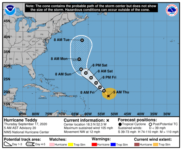
At 5am, Hurricane Teddy was located near latitude 18.3 north and longitude 52.3 west or about 625 miles east north-east of the Lesser Antilles, moving north-westward at 12mph. Based on the current projected track, this system is NOT expected to pose a direct threat to Dominica. However, residents should stay updated on weather information.
Swells associated with Teddy are expected to affect the eastern coastline during the next 24 to 48 hours with heights up to 10.0ft expected. A Small Craft Warning and High Surf Advisory is in effect from 6am today Thursday 17th September, 2020. Small craft operators, particularly along the north, northeastern and eastern coastlines, should exercise extreme caution. Sea bathers are advised to stay out of the water.
Disclaimer: The comments posted do not necessarily reflect the views of DominicaNewsOnline.com and its parent company or any individual staff member. All comments are posted subject to approval by DominicaNewsOnline.com. We never censor based on political or ideological points of view, but we do try to maintain a sensible balance between free speech and responsible moderating.
We will delete comments that:
See our full comment/user policy/agreement.