


Lingering moisture following the passage of a slow-moving tropical wave, together with the presence of an upper level trough are expected to continue to produce an increase in cloudiness, with periods of light to moderate showers and possible isolated thunderstorm activity across the island chain, including Dominica, during the next 24 to 36 hours.
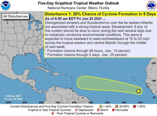
People in areas prone to flooding, landslides and falling rocks are advised to be vigilant during the period. A relative improvement in conditions can be expected by late Saturday with another tropical wave expected to move across the area on Monday. Meanwhile, a strong tropical wave located in the far Eastern Atlantic is being monitored for development and expected to approach the area by Wednesday of next week.
Dust haze will continue to linger in varying concentration across the area during the next few days. People with respiratory sensitivities are advised to continue taking the necessary precautions to avoid complications.
Moderate seas are anticipated during the next 24 hours with waves peaking near 7.0ft.
Disclaimer: The comments posted do not necessarily reflect the views of DominicaNewsOnline.com and its parent company or any individual staff member. All comments are posted subject to approval by DominicaNewsOnline.com. We never censor based on political or ideological points of view, but we do try to maintain a sensible balance between free speech and responsible moderating.
We will delete comments that:
See our full comment/user policy/agreement.