


A Flood Warning means that flooding is already occurring or will occur during the warning period.
- Valid until 6pm Tuesday, October 03rd 2023
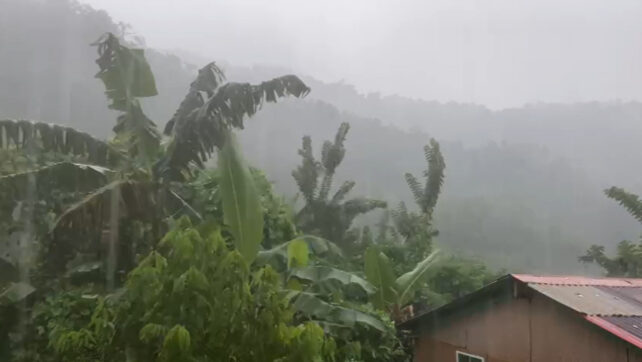
- The passage of Tropical Storm Phillipe will continue to affect the area, generating cloudy to overcast skies, moderate to heavy showers and thunderstorms across Dominica, during the next 12 to 24 hours.
- Near 50 to 75 mm or 2 to 3 inches of rainfall has been recorded in some communities in the northern, eastern and interior of the island, during the past 4 hours.
- An additional 50 to 75mm (2 to 3 inches) is possible tonight into tomorrow, which can result in localized flash flooding.
People in areas that are prone to flooding, landslide and falling rocks should be vigilant and take all precautionary measures to protect life and property. Stay away from flooded bridges and vulnerable roadways.
EXPECTED IMPACTS FOR DOMINICA
- Rivers, streams, gutters and ravines may overflow their banks and flood surrounding areas
- Landslides due to intense rainfall as well as rock falls from overhanging cliffs
- Ponding will occur on roadways and bridges
- Seas will become dangerous for sea-bathers and small-craft operators in gusty winds.
The Meteorological Service will continue to monitor the situation and provide updates as necessary.
Disclaimer: The comments posted do not necessarily reflect the views of DominicaNewsOnline.com and its parent company or any individual staff member. All comments are posted subject to approval by DominicaNewsOnline.com. We never censor based on political or ideological points of view, but we do try to maintain a sensible balance between free speech and responsible moderating.
We will delete comments that:
See our full comment/user policy/agreement.