


As tropical wave activity intensifies off the coast of Africa and atmospheric conditions across the Atlantic become increasingly favorable, AccuWeather® hurricane experts are forecasting a surge in tropical storm formation during August, with three to five named storms expected to develop.
The next names on the Atlantic basin storm list are Erin, Fernand, and Gabrielle, with Tropical Storm Dexter already having made its mark earlier this month.
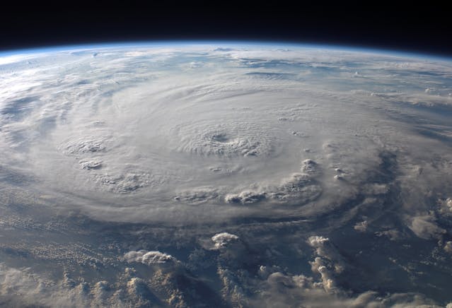
Meteorologists are currently keeping a close watch on four distinct zones within the Atlantic basin that show potential for tropical development. These include a low-risk area situated in the Gulf of Mexico, another low-risk zone just off the U.S. East Coast, a medium-risk region in the central Atlantic, and a high-risk area located farther east in the Atlantic.
According to Senior Meteorologist Chad Merrill, a large plume of Saharan dust is currently sweeping off the African coast, temporarily suppressing storm formation in the main development region. However, this dust is expected to dissipate by mid-next week, paving the way for more favorable conditions for thunderstorm clusters and tropical waves.
“We see an eventual favorable environment for thunderstorm clusters coming off the coast of Africa,” Merrill said. “The timeline for any potential impact to the Caribbean or the U.S. is Aug. 17 to 22.”
Merrill noted that Erin is likely to form by early next week, evolving from a low-pressure system in the central Atlantic. While this system has a high chance of becoming a tropical depression or storm, it is expected to recurve near or east of Bermuda, posing no direct threat to the U.S.
Fernand, the next name in line, may emerge from a tropical wave currently moving off the African coast. AccuWeather® is closely monitoring this wave, as it could approach the Caribbean and possibly the U.S. East Coast by mid- to late August.
While no immediate threats are projected, AccuWeather® experts caution that parts of the central and eastern Gulf Coast, as well as the Atlantic coast from South Florida to Virginia Beach, may experience occasional tropical rain and wind impacts through mid- to late August.
“We typically see four named storms form in the Atlantic basin during the month of August,” Merrill said. “The tropical activity we’re seeing right now is normal, not unusual.”
After an unusually quiet August and early September in 2024, this year’s uptick in activity marks a return to historical averages. With multiple systems brewing and conditions aligning, AccuWeather® continues to monitor the Atlantic basin closely, urging residents in vulnerable areas to stay informed and prepared.
no shi. sherlock thats when it surges every year
Just the hype I expected from these alarmist meteorologists. However, I hope that this hurricane season will be mostly uneventful. Dominica nor any of the other Caribbean countries are in any economic position to recover from a possible direct hit from even a strong tropical storm.
May any storms brewing off the west coast of Africa in the Atlantic Ocean dissipate before reaching the Caribbean archipelago.