


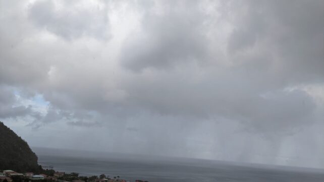
 The passage of a tropical wave and the presence of a trough system are expected to result increased cloudiness, scattered showers and possible isolated thunderstorms on the island, particularly from overnight into Wednesday. People in areas prone to flooding, landslides and falling rocks are advised to be on alert and to exercise caution during the period.
The Met office continues to monitor the progress of a tropical wave and its area of low pressure in the central tropical Atlantic. This system has a high chance of development into a tropical depression or storm, over the next day or two and is projected to be near the northern Leeward islands by the weekend. Residents are advised to continue to monitor for updates on the progress of this system.
Slight to moderate seas can be expected over the next few days, with wave heights reaching up to 3 feet along the west coast and up to 5 feet along the east coast.
Disclaimer: The comments posted do not necessarily reflect the views of DominicaNewsOnline.com and its parent company or any individual staff member. All comments are posted subject to approval by DominicaNewsOnline.com. We never censor based on political or ideological points of view, but we do try to maintain a sensible balance between free speech and responsible moderating.
We will delete comments that:
See our full comment/user policy/agreement.