


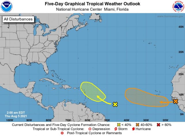
A tropical wave is expected to affect the Lesser Antilles during the next 24 hours. Increased cloudiness with scattered showers and isolated thunderstorms can be expected across the island chain during the period. During the weekend, a tropical wave with a low chance of development, is expected to generate an increase in shower and possible thunderstorm activity across the area.
Meanwhile, another tropical wave forecast to move off the African coast later today is being monitored for further development and is expected in the area by Tuesday of next week.
Slight dust haze is expected across the area during the next few days. People with respiratory sensitivities should take the necessary precautions to avoid complications.
Slight to moderate seas are anticipated during the next 24 hours with waves peaking to 5.0ft.
Disclaimer: The comments posted do not necessarily reflect the views of DominicaNewsOnline.com and its parent company or any individual staff member. All comments are posted subject to approval by DominicaNewsOnline.com. We never censor based on political or ideological points of view, but we do try to maintain a sensible balance between free speech and responsible moderating.
We will delete comments that:
See our full comment/user policy/agreement.