


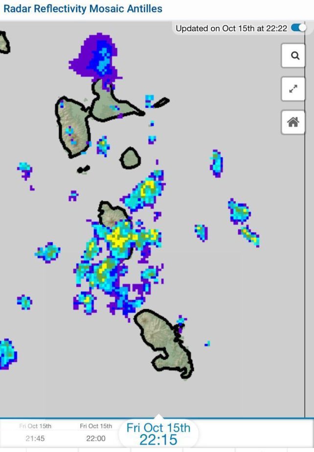
 A weak tropical wave together with the presence of a low to mid-level trough is expected to produce an increase in cloudiness, scattered showers and a chance of isolated thunderstorms across the area mainly during tonight. Shower and thunderstorm activity could become moderate to heavy at times. People in areas prone to flooding, landslides and falling rocks should exercise caution during tonight. Thereafter, a high pressure system is expected to result in a relatively dry atmosphere during tomorrow as the day progresses.
Moderate seas are anticipated during the next 24 hours with swells peaking near 7.0ft. A High Surf Advisory is in effect for above normal seas on the eastern coast. Small craft operators and sea bathers should exercise caution. Light winds are expected over the next few days with a gradual reduction in swells expected by tomorrow.
Disclaimer: The comments posted do not necessarily reflect the views of DominicaNewsOnline.com and its parent company or any individual staff member. All comments are posted subject to approval by DominicaNewsOnline.com. We never censor based on political or ideological points of view, but we do try to maintain a sensible balance between free speech and responsible moderating.
We will delete comments that:
See our full comment/user policy/agreement.