


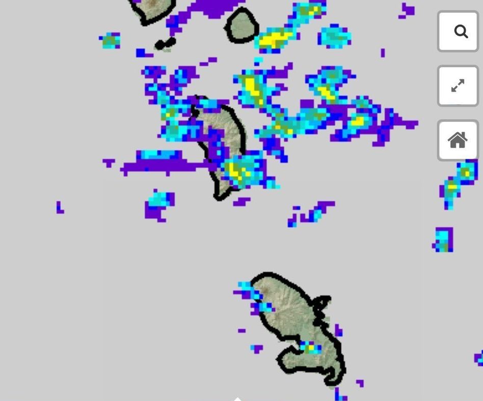
 By tonight into tomorrow, a tropical wave is expected to produce an increase in cloudiness with showers, which could be moderate to heavy at times, and isolated thunderstorms are expected across the area. People in areas prone to flooding, landslides and falling rocks should remain on alert during the period. A flood watch or warning may become necessary at short notice during the period.
An increase in dust haze concentration will be maintained across the area during the next 24 hours. People with respiratory sensitivities should take all precautions to avoid complications.
Moderate seas are anticipated during the next 24 hours with waves peaking to 8.0ft.Small craft operators and sea bathers on the east coast should exercise caution as a small craft advisory is now in effect.
Disclaimer: The comments posted do not necessarily reflect the views of DominicaNewsOnline.com and its parent company or any individual staff member. All comments are posted subject to approval by DominicaNewsOnline.com. We never censor based on political or ideological points of view, but we do try to maintain a sensible balance between free speech and responsible moderating.
We will delete comments that:
See our full comment/user policy/agreement.